搜索结果: 1-15 共查到“测绘科学技术 Geoinformatics”相关记录18条 . 查询时间(0.077 秒)
2017年第六届农业地理信息学国际会议(2017 6th International Conference on Agro-Geoinformatics)
2017年 第六届 农业地理信息学 国际会议
2017/7/18
The Sixth International Conference on Agro-Geoinformatics (Agro-Geoinformatics 2017) will be held in Fairfax VA, USA on August 7-10, 2017. This conference is organized and hosted by Center for spatial...
LAND USE/LAND COVER CHANGES IN SEMI-ARID MOUNTAIN LANDSCAPE IN SOUTHERN INDIA: A GEOINFORMATICS BASED MARKOV CHAIN APPROACH
Land cover Markov Kallar NDVI Drought Geoinformatics
2017/7/12
Nowadays land use/ land cover in mountain landscape is in critical condition; it leads to high risky and uncertain environments. These areas are facing multiple stresses including degradation of land ...
The Geoinformatics conference series was initiated by the International Association of Chinese Professionals in Geographic Information Sciences (CPGIS) in 1992. This international conference series ha...
24th International Conference on Geoinformatics
Environmental information system Remote sensing sciences
2016/7/27
The Geoinformatics conference series was initiated by the International Association of Chinese Professionals in Geographic Information Sciences (CPGIS) in 1992. This international conference series ha...
HYDROLOGICAL MODEL DEVELOPMENT USING GEOINFORMATICS FOR PALERU RIVER, ANDHRA PRADESH, INDIA
Rainfall discharge DEM
2015/8/28
In the present study, an attempt has been made to generate runoff using Up-scaled
Physically based (UP), rainfall – runoff model in the Paleru catchment covered in Andhra
Pradesh state. Hourly and d...
GEOINFORMATICS SUPPORT FOR INFORMATION BASED AGRICULTURE: A CASE STUDY OF ARID TRACT OF PUNJAB
Nutrients Ground Water Quality Soil
2015/8/28
Information based agriculture (IBA) includes matching of agronomic practices with soil and water characteristics and their spatial
variability for enhancing productivity. An attempt was made to deriv...
CAPACITY BUILDING FOR GEOINFORMATICS IN AFRICA AN ITC PERSPECTIVE
Education Geoinformatics Decentralisation Capacity Building Institutional Strengthening
2015/3/11
The development of Geoinformatics over the last two decades and with that the growing awareness of the role of GDI in civil society imply that professionals of different types are required by organisa...
NEW TRAINING MANDATES FOR SURVEYING AND GEOINFORMATICS INSTITUTIONS IN NIGERIA
Surveying Geoinformatics Training Curricula New Mandates
2015/1/23
Recent advances in computer, satellite, digital technologies and geographic information system have had a tremendous impact on the field of surveying and mapping. It has affected the scope, methods, v...
CURRICULUM OF GEOINFORMATICS – INTEGRATION OF REMOTE SENSING AND GEOGRAPHICAL INFORMATION TECHNOLOGY
Geoinformatics Geoinformation technique Remote Sensing Information technique Curriculum Surveyor
2015/1/23
This paper describes the development of Geoinformatics at Helsinki University of Technology as an independent curriculum in surveying studies. Geoinformatics includes Geoinformation Technique and Remo...
Study of Landcover Change in Yelwa-Heipang Area of Plateau State, North-Central Nigeria: A Geoinformatics Approach
Nigeriasat-X Land Use Land Cover Landsat Processing
2014/12/4
This study is a research programme carried out to detect the change in land use/land cover of Yelwa-Heipang area of Plateau State, North Central Nigeria. It lies within the South-Eastern part of the J...
GEOINFORMATICS EDUCATION IN CHINA
Geoinformatics, Surveying and Mapping Remote Sensing Science and Technology
2014/7/23
The paper will give an overview of the current status of education in Geoinformatics in China. First, the paper will provide a general
review of the scientific and technological development of Geoin...
The 22nd International Conference on Geoinformatics, Kaohsiung, Taiwan
The 22nd International Conference on Geoinformatics Kaohsiung Taiwan
2014/3/5
The Geoinformatics conference series was initiated by the International Association of Chinese Professionals in Geographic Information Sciences (CPGIS) in 1992. This international conference series ha...

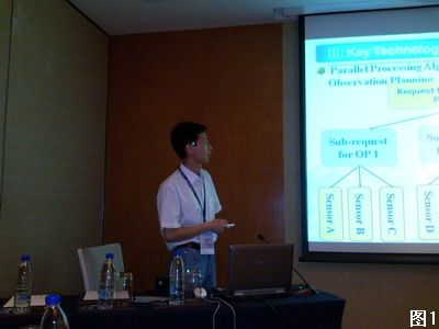
2011年6月24-26日,第19届地理信息科学国际会议(The 9th International Conference on GeoInformatics)在中国上海召开。对地观测技术应用研究部汪超亮副研究员和冯磊博士参加了本次会议。
SATELLITE BASED LIVE AND INTERACTIVE DISTANCE LEARNING PROGRAM IN THE FIELD OF GEOINFORMATICS – A PERSPECTIVE OF INDIAN INSTITUTE OF REMOTE SENSING, INDIA
Distance Learning Program Satellite based live programs EDUSAT Outreach for Universities Geoinformatics
2014/5/9
Geoinformatics is a highly specialized discipline that deals with Remote Sensing, Geographical Information System (GIS), Global Positioning System (GPS) and field surveys for assessing, quantification...
Morphodynamic Changes of Bhagirathi River at Murshidabad District Using Geoinformatics
Ox-bow Lake Meander Cut-off Sinuosity Index (S. I) Meander Belt Braiding Index Etc
2013/3/5
The channel of Bhagirathi River is the branches off from the Ganga at Nurpur (lower course of the Ganga). Bhagirathi River is one of the main rivers in Murshidabad district. Analyzing the image of the...

